
The Los Angeles River is infrastructure, habitat, public space, and a corridor of communities—not a single scenic attraction.
Choose a named reach
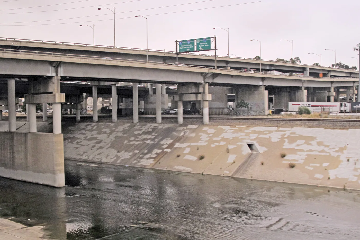
The river changes across the basin. Concrete flood-control sections, soft-bottom reaches, bridges, rail and road infrastructure, parks, tributaries, and habitat require different expectations. Start with a precise access point and current information rather than setting out to “see the river” as one continuous place.

West Harbor LA 45-Minute Narrated Harbor Cruise of San Pedro
Join us as we explore the amazing Port of Los Angeles, the busiest harbor in the Western Hemisphere. You'll learn the history of the port and see Cali...

Best of Los Angeles Guided City Tour with 4 Stops and Free Time
Check out the BEST Los Angeles has to offer on this half-day interactive sightseeing experience! Take a seat on one...

Full-Day Iconic Sights of LA, Hollywood, Beverly Hills, Beaches and More
This 7.5 hour guided tour - by LA-natives - is perfect for families, couples and all ages! Our routes are carefully...

Warner Bros. Studio Tour Hollywood
Our Studio Tour brings you closer than ever to the entertainment you love. You’ll explore one of the busiest worki...
A named reach also keeps directions honest. The distance between two bridges may look modest on a map while legal entry points, gates, construction, or street crossings make the route longer. Identify where you will enter, where you will leave, and which public agency manages the adjacent path or park.
Read the engineered landscape honestly
Concrete is not evidence that the river has no ecology or history, and a green reach is not evidence that the entire system is a conventional blue river. Flood safety, habitat restoration, access, displacement, and neighborhood priorities can exist in tension. Good interpretation makes those layers visible without turning them into a romantic texture.
Let bridges explain the city
Bridges reveal the relationship between water infrastructure, rail, freeways, industry, neighborhoods, and the Downtown edge. Observe from lawful, safe public space and keep moving traffic in mind. A bridge can be a useful orientation point without becoming a backdrop that erases the communities on either bank.
Historic photographs and engineering records can add context, but current conditions need current sources. A restoration plan, habitat project, or path proposal may change over time. Distinguish what exists now from what an agency has proposed or is building.
Check conditions
- Confirm path, gate, and park status with the responsible public agency.
- Check heat, rain, air quality, and flood warnings.
- Identify safe crossings before walking along the corridor.
- Carry water and shade appropriate to conditions.
- Respect habitat, private property, work zones, and community spaces.
Photograph the system, not a fantasy
Include enough of the channel, bridge, vegetation, or surrounding grid to explain where the image was made. Do not color the water blue, erase infrastructure, or crop a green patch so tightly that it appears to represent the full river. If a mural or artwork is central, identify the artist and confirm the work rather than using it as an anonymous pattern.
After the broad view, look for one close material detail: expansion joints, aggregate, drainage marks, planted edges, or the shadow of a bridge. That shift in scale makes the corridor legible while keeping the photograph documentary.
Pair a river reach with one nearby neighborhood or cultural institution instead of using the corridor only as a drive-by photograph. The broader planning method in our region and light guide can help keep that pairing realistic.